Social Media and Big Data for better MIS and GIS Teaching and Learning
Professional Bios: Mehrdad Koohikamali & James Pick
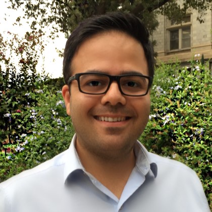
 Dr. Mehrdad Koohikamali Received his a masters in Geomatics engineering from the University of Tehran (2009), masters in Applied GIS from university of North Texas (2014) as well as a PhD in Business Computer Information Systems (2016). Mehrdad’s experience focuses in different areas of GIS. He has a broad range of GIS experience from data collection and field surveying, spatial analysis, satellite imagery analysis, lidar data processing and modeling, software development, spatial database implementation, project management, and proposal and contract analysis. His background in geomatics engineering has given him necessary understanding to work as a true GIS expert with respect to geographical aspects. Mehrdad has also done several GIS projects with open source software packages. His close work with various industries helped him to gain a thorough knowledge of how to cooperate with experts from different backgrounds.
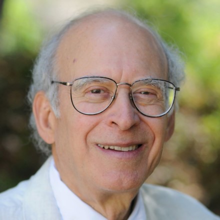
 Dr. James B. Pick holds a B.A. from Northwestern University, M.S. from Northern Illinois University, and Ph.D. from University of California, Irvine. he works in research and teaching in management information systems, urban studies and population, geographic information systems, and renewable energy. He is past chair of Department of Management and Business, past assembly chair of School of Business, and founding director of Center for Business GIS and Spatial Analysis. He is the author of twelve books and 150 peer-reviewed scientific papers and book chapters. His most recent books are The Global Digital Divides: Explaining Change, co-authored with Avijit Sarkar (Springer, 2015), Exploring the Urban Community: A GIS Approach, co-authored with Richard Greene (Pearson/Prentice Hall, 2012), and Geo-Business: GIS in the Digital Organization (John Wiley and Sons, 2008). Dr. Pick has been principal investigator or co-PI on grants from the Ford Foundation, U.S. Small Business Administration, and University of California. His awards include seven for faculty distinguished research and teaching from the University of Redlands, Senior Fulbright scholar award for Mexico, and outstanding alumnus award from Northern Illinois University. He was visiting researcher at UC Irvine four times, as well as visiting scholar at City University of Hong Kong and Chinese Academy of Sciences in 2012, visiting scholar at Lingnan University, Hong Kong in 2009, and at Universidad Iberoamerica, Mexico City in 1997 and 2001. He is currently doing research projects on the United States digital divide and on socio-economic and spatial aspects of renewable energy development in California.
Project Summary:
Students want their instructors to use social media. Most social media users access their accounts on mobile devices. By using social media as a complementary learning tool, students and instructor are able to post materials or discuss on a topic without any time and place limitations. Research shows engagement and interaction through social media is more effective than traditional Moodle or Blackboard discussion boards. By using a specific hashtag for a course, social media content is formed together as a medium for group discussion. Students and instructors are able to participate in topic/case-study/project/news discussions all the time. In addition, there has always been a separation between discussions among different course sections being taught concurrently or over time. Preserving group and individual discussions, provides, from one course to the next, a continuous opportunity for students and instructors to keep working on a topic/project outside the classroom or into the future. Students’ ideas and discussions will be protected as their intellectual properties, and other students, even from the future, would be able to participate in the old discussion or interact with them.
In the case of Facebook, the user’s GPS position for photos is not geo-tagged without the user’s permission. With permission granted, the user is then able to produce a map showing the location of geo-tagged content. A Facebook photo or page can also be tagged by denoting, for other any page in Facebook, whether or not it is near to the actual photo or page. Facebook also has a feature, the “Map” box that allows viewing of a map of photos or other content items that are geo-tagged. Upon completion of this proposed project, students are able to use a developed application to extract and analyze different themes related to various topics. Furthermore, they can visualize important trends within different locations/areas as well as around a specific topic. After developing and implementing a tool to capture big data available on social media, and then determining its quality, the student may visualize trends in the data based on topics of interest and location. In addition, students will be able to import derived social media data into the Insights for ArcGIS tool, which is a new tool to be released soon, which runs location intelligence analytics. As a part of the grant, instructors will develop assignments to practically examine its capabilities.
�

 Dr. Mehrdad Koohikamali Received his a masters in Geomatics engineering from the University of Tehran (2009), masters in Applied GIS from university of North Texas (2014) as well as a PhD in Business Computer Information Systems (2016). Mehrdad’s experience focuses in different areas of GIS. He has a broad range of GIS experience from data collection and field surveying, spatial analysis, satellite imagery analysis, lidar data processing and modeling, software development, spatial database implementation, project management, and proposal and contract analysis. His background in geomatics engineering has given him necessary understanding to work as a true GIS expert with respect to geographical aspects. Mehrdad has also done several GIS projects with open source software packages. His close work with various industries helped him to gain a thorough knowledge of how to cooperate with experts from different backgrounds.
 Dr. James B. Pick holds a B.A. from Northwestern University, M.S. from Northern Illinois University, and Ph.D. from University of California, Irvine. he works in research and teaching in management information systems, urban studies and population, geographic information systems, and renewable energy. He is past chair of Department of Management and Business, past assembly chair of School of Business, and founding director of Center for Business GIS and Spatial Analysis. He is the author of twelve books and 150 peer-reviewed scientific papers and book chapters. His most recent books are The Global Digital Divides: Explaining Change, co-authored with Avijit Sarkar (Springer, 2015), Exploring the Urban Community: A GIS Approach, co-authored with Richard Greene (Pearson/Prentice Hall, 2012), and Geo-Business: GIS in the Digital Organization (John Wiley and Sons, 2008). Dr. Pick has been principal investigator or co-PI on grants from the Ford Foundation, U.S. Small Business Administration, and University of California. His awards include seven for faculty distinguished research and teaching from the University of Redlands, Senior Fulbright scholar award for Mexico, and outstanding alumnus award from Northern Illinois University. He was visiting researcher at UC Irvine four times, as well as visiting scholar at City University of Hong Kong and Chinese Academy of Sciences in 2012, visiting scholar at Lingnan University, Hong Kong in 2009, and at Universidad Iberoamerica, Mexico City in 1997 and 2001. He is currently doing research projects on the United States digital divide and on socio-economic and spatial aspects of renewable energy development in California.